Difference between revisions of "GeoExplorer"
From Gcube Wiki
| Line 1: | Line 1: | ||
| − | The GeoExplorer Portlet is a web application that allows users to navigate, organize, analyze, search and discovery internal or external | + | The GeoExplorer Portlet is a web application that allows users to interactive navigate, organize, analyze, search and discovery internal or external '''layers'''. GeoExplorer Portlet operating on a '''GeoNetwork''' instance in order to discover layers residing on a '''distributed e-Infrastructure'''. |
| − | + | == Overview == | |
| + | |||
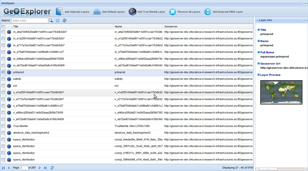
| + | [[File:GeoExplorer_screenshot1.jpg|500px|thumb|right|GeoExplorer Portlet startup screenshot]] | ||
| + | |||
| + | The GeoExplorer Portlet provides the following facilities: | ||
* Internal layers exploration (preview, sorting, filtering, multi-selecion); | * Internal layers exploration (preview, sorting, filtering, multi-selecion); | ||
* Interactive layers visualization on a Geospatial Map (zoom & pan); | * Interactive layers visualization on a Geospatial Map (zoom & pan); | ||
| Line 10: | Line 14: | ||
* Default Base Layers visualization (TrueMarble, GEBCO, relief, and so on); | * Default Base Layers visualization (TrueMarble, GEBCO, relief, and so on); | ||
* External WMS Layer management; | * External WMS Layer management; | ||
| + | |||
| + | The webapp is partitioned into two logical components: the '''GeoExplorer''' area and the GisViewer area. | ||
| + | |||
| + | |||
| + | == GeoExplorer Component == | ||
| + | |||
| + | == GisViewer Component == | ||
Revision as of 14:11, 25 June 2012
The GeoExplorer Portlet is a web application that allows users to interactive navigate, organize, analyze, search and discovery internal or external layers. GeoExplorer Portlet operating on a GeoNetwork instance in order to discover layers residing on a distributed e-Infrastructure.
Overview
The GeoExplorer Portlet provides the following facilities:
- Internal layers exploration (preview, sorting, filtering, multi-selecion);
- Interactive layers visualization on a Geospatial Map (zoom & pan);
- Visual correlation analysis of several overlying layers;
- CQL visual Filter of one or more layers;
- Tabular spatial data retrieval of one or more layers;
- Transect layers analysis;
- Default Base Layers visualization (TrueMarble, GEBCO, relief, and so on);
- External WMS Layer management;
The webapp is partitioned into two logical components: the GeoExplorer area and the GisViewer area.
