Difference between revisions of "Statistical Algorithms Importer: Advanced Input"
From Gcube Wiki
(→Spatial Data in SAI) |
(→Temporal Data in SAI) |
||
| Line 97: | Line 97: | ||
==Temporal Data== | ==Temporal Data== | ||
| − | ===Temporal Data in SAI=== | + | ===Temporal Data in SAI=== |
| + | :Temporal Data is supported by SAI using specific tags in the description of inputs | ||
===Temporal Data in DataMiner=== | ===Temporal Data in DataMiner=== | ||
Revision as of 15:19, 4 October 2016
- This page explains how to use Advanced Input using Statistical Algorithms Importer(SAI) portlet.
Spatial Data
Spatial Data in SAI
- Spatial Data is supported by Well-known text (WKT) that is a text markup language for representing vector geometry objects on a map, spatial reference systems of spatial objects and transformations between spatial reference systems.[1]
- When you define the algorithm's input in SAI you can support WKT input using the appropriate descriptions. You must add the tag(in red) that identifies WKT information to your description. This is an example, note that text in square brackets is mandatory:
| Name | Description | Type | Default | I/O |
|---|---|---|---|---|
| wktPoint | wktPoint [WKT_POINT] | String | POINT(-12993071.816027395 7729312.300197024) | Input |
| wktLineString | wktLineString [WKT_LINESTRING] | String | LINESTRING(-16476154.320926309 7161843.802207875,-14617205.79303082 7514065.628545967,-12777825.14437634 6790054.096628778,-12601714.231207293 8081534.126535116,-11271098.442818945 7416226.232340941,-11329802.08054196 6261721.357121639) | Input |
| wktPolygon | wktPolygon [WKT_POLYGON] | String | POLYGON((-15967389.460660174 7377090.473858931,-14264983.966692729 8257645.039704162,-12895232.41982237 7416226.232340941,-13423565.159329507 5811660.134578522,-13932330.019595642 7181411.681448881,-16123932.494588215 6750918.338146768,-15967389.460660174 7377090.473858931)) | Input |
| wktTriangle | wktTriangle [WKT_TRIANGLE] | String | POLYGON((-16495722.200167313 7259683.198412901,-15855087.594353283 8572650.25102042,-17312467.71915039 8470972.56789504,-16495722.200167313 7259683.198412901)) | Input |
| wktSquare | wktSquare [WKT_SQUARE] | String | POLYGON((-16495722.200167313 7259683.198412901,-15855087.594353283 8572650.25102042,-17312467.71915039 8470972.56789504,-16495722.200167313 7259683.198412901)) | Input |
| wktPentagon | wktPentagon [WKT_PENTAGON] | String | POLYGON((-14284551.845933735 6437832.270290686,-13783375.299284551 7626538.339655062,-14759029.882416394 8470515.936910307,-15863194.122720666 7803416.7083931435,-15569950.56925907 6547149.114045457,-14284551.845933735 6437832.270290686)) | Input |
| wktHexagon | wktHexagon [WKT_HEXAGON] | String | POLYGON((-11995109.97473614 8492459.590596221,-11950593.230512831 9941648.908612307,-13183369.622696154 10704796.199011508,-14460662.759102784 10018754.171394624,-14505179.503326092 8569564.853378538,-13272403.11114277 7806417.562979337,-11995109.97473614 8492459.590596221)) | Input |
| wktBox | wktBox [WKT_BOX] | String | POLYGON((-11995109.97473614 8492459.590596221,-11950593.230512831 9941648.908612307,-13183369.622696154 10704796.199011508,-14460662.759102784 10018754.171394624,-14505179.503326092 8569564.853378538,-13272403.11114277 7806417.562979337,-11995109.97473614 8492459.590596221)) | Input |
| wktCircle | wktCircle [WKT_CIRCLE] | String | POLYGON((-12582146.351966292 8101102.005776119,-12437487.643413674 8354330.862998396,-12345011.010682397 8630915.512769304,-12308270.27890683 8920226.962108605,-12328677.373804664 9211147.13426592,-12405448.062163413 9492496.130175157,-12535632.089482944 9753461.865705855,-12714226.55660141 9984015.573992845,-12934368.178304384 10175297.205322662,-13187597.035526661 10319955.91387528,-13464181.68529757 10412432.546606557,-13753493.13463687 10449173.278382126,-14044413.306794185 10428766.18348429,-14325762.302703422 10351995.495125541,-14586728.03823412 10221811.467806011,-14817281.74652111 10043217.000687543,-15008563.377850927 9823075.37898457,-15153222.086403545 9569846.521762293,-15245698.719134822 9293261.871991385,-15282439.45091039 9003950.422652084,-15262032.356012555 8713030.250494769,-15185261.667653807 8431681.254585532,-15055077.640334276 8170715.519054834,-14876483.173215808 7940161.810767845,-14656341.551512836 7748880.179438027,-14403112.694290558 7604221.470885409,-14126528.04451965 7511744.838154132,-13837216.59518035 7475004.106378564,-13546296.423023034 7495411.2012764,-13264947.427113798 7572181.8896351475,-13003981.691583099 7702365.9169546785,-12773427.983296111 7880960.384073146,-12582146.351966292 8101102.005776119)) | Input |
Spatial Data in DataMiner
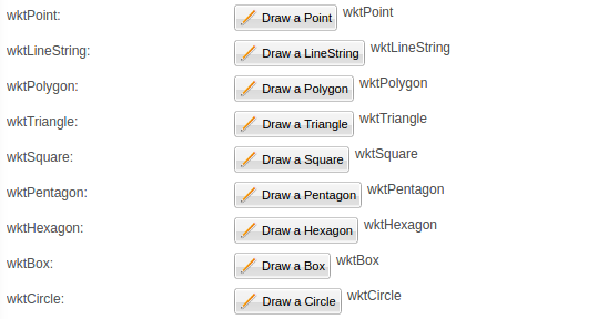
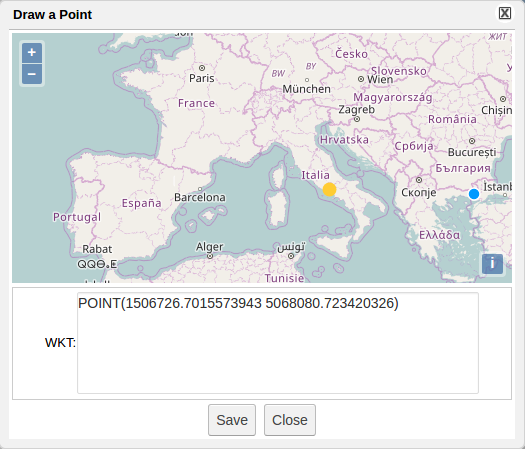
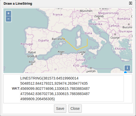
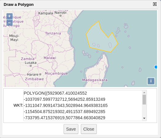
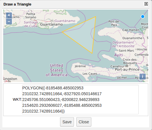
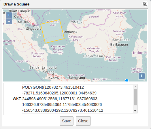
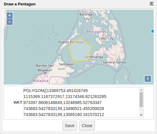
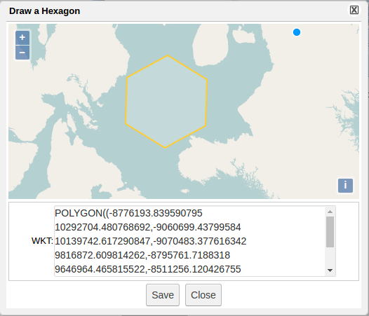
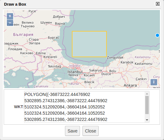
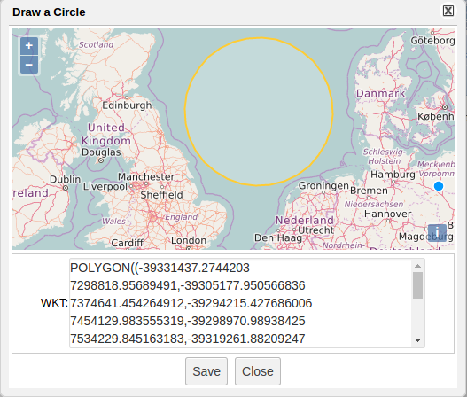
- DataMiner shows Spatial Data by an specific widget which allows easy selection of the interest's area, and shows the coordinates selected in the text area:
Temporal Data
Temporal Data in SAI
- Temporal Data is supported by SAI using specific tags in the description of inputs
Temporal Data in DataMiner
- Temporal Data is supported by specific widget
